Caserta

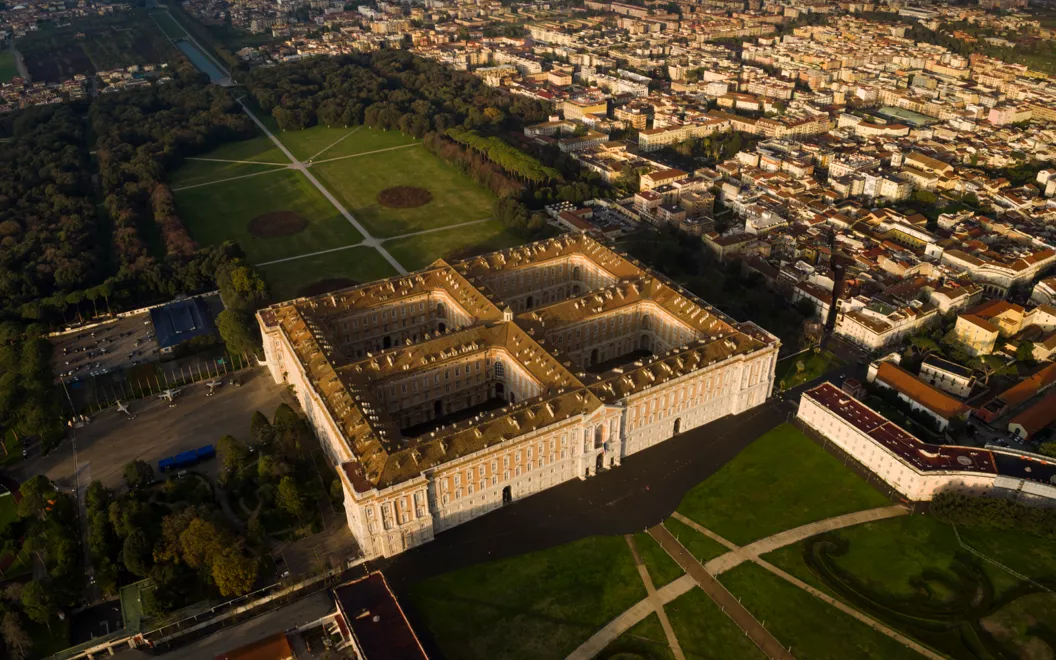
There are cities where the presence of a formidable monument, universally loved and visited by tourists from all over, risks overshadowing all that is interesting in its surroundings. This is certainly the case with the Royal Palace of Caserta: a residential complex of exorbitant dimensions, financed by the King of Naples, Charles of Bourbon, from 1752. The palace is considered the masterpiece project of Luigi Vanvitelli, an interpreter of a style straddling the late Baroque, Rococo and early neoclassicism.
Perhaps even more astonishing than the palace's opulent interior is the park, which stretches northwards from the Royal Palace of Caserta for about 3 km, adorned with bridges and sculptures, waterfalls and fountains. The fascinating water features distributed among the palace's pleasant alleys are fed by an aqueduct specially designed by Vanvitelli, almost 40 km long. Inevitably, this monumental structure was also dedicated to its patron, Charles of Bourbon: that is why it is still known today as the Carolino aqueduct.
You then have to leave the gates of the mammoth royal residence to discover in the streets of the historical centre another Caserta, one that is often overlooked by international tourism. Some wide streets laid out along an orthogonal layout, such as Corso Trieste and Corso Giannone, are pleasant to walk along: the pavements are home to dozens of shops, bars and restaurants, whose signs are dominated by the profile of the city's cathedral, completed in the 19th century and dedicated to St Michael Archangel.
Belvedere di S. Leucio

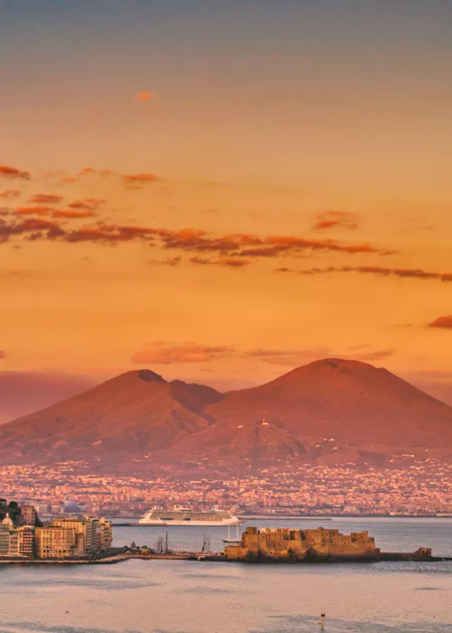
Included in the UNESCO World Heritage Site of the Palace of Caserta, the monumental complex of S. Leucio is located about three kilometres north of the royal residence, at the end of the Bourbon park. Lying on the first Apennine hills, the cultural site of San Leucio offers a breathtaking view of the city of Caserta from its belvedere: on particularly clear days, you can see as far as the Gulf of Naples, dominated by the unmistakable profile of Vesuvius.
As with the Royal Palace of Caserta, the reigning dynasty of the Bourbons also played a key role in the conception of the St. Leucio complex. Ferdinand IV, son of Charles of Bourbon, wanted to build an ideal industrial city in S. Leucio to be dedicated to the production of silk, according to an 18th-century Enlightenment welfare model. The comfortable and spacious workers' quarters were to be arranged harmoniously around the silk factory. The project then included a school, a church and everything necessary to create around the factory a modern eighteenth-century village surrounded by the lush nature of Campania felix.
Not all of Ferdinand IV's pioneering ideas were brought to fruition, as is well recounted in the Silk Museum, part of a tour that makes S. Leucio a must-see destination on a trip to the province of Caserta.
Casertavecchia

Originally part of the city of Caserta, Casertavecchia is now a picturesque medieval village, just a few minutes' drive from S. Leucio. The settlement began to develop at the behest of the Longobards, who chose the prosperous slopes of Mount Virgo to found this settlement more than a millennium ago. The very origin of the toponym of Caserta seems to derive from Casa Irta, indicating the particularly steep position of the village.
From about 400 metres above sea level, Casertavecchia opens up wide views of the surrounding plain, but it is among its winding alleys that the town unveils its best-known masterpiece: the Cathedral of S. Michele Arcangelo. The Cathedral of Casertavecchia remained a fundamental reference point for the local religious community at least until the massive eighteenth-century urban development of Bourbon Caserta, scattered along the underlying plain. Everything in this cathedral contributes to the sensation of architectural harmony for the beholder: the marble portals, the plant motifs, the small columns and arches, up to the great bell tower that reaches a height of 32 metres.
It is a pity that the castle of Casertavecchia was not preserved intact when the city's cathedral was built: however, it is worth walking a little further east of the historic centre to imagine what this defensive fort would have looked like in medieval times
Santa Maria Capua Vetere

In ancient times, the current province of Caserta was a very fertile and populated area, dominated at the centre by the urban settlement of ancient Capua, probably founded by the Italic population of the Osci about three thousand years ago.
Today, on the vestiges of classical Capua (not to be confused with modern Capua, just to the north) is the urban fabric of modern Santa Maria Capua Vetere, about 5 km west of the Palace of Caserta. After the destruction of ancient Capua during the barbarian invasions, only the medieval structure of the Cathedral of S. Maria Maggiore remained standing: hence the place name Santa Maria Capua Vetere, i.e., the city of Mary resurrected on the site of old Capua.
Today, the city is definitely worth an in-depth visit for its archaeological finds. Among the streets of Santa Maria Capua Vetere, in fact, some millenary remains of great charm and importance are still visible: just think of the colossal Campanian amphitheatre or the Mithraeum, an underground temple dedicated to the Persian god Mithras. The Archaeological Museum of Ancient Capua is also the ideal place to retrace the artistic and architectural history of this town. Before continuing the route to the north, a short walk through the spacious streets of the nineteenth-century district of Santa Maria Capua Vetere, which housed the homes of some wealthy bourgeois families, is also recommended.
Basilica of St Angelo in Formis

Overlooking a hill on the municipal territory of modern Capua, a few minutes' drive from Santa Maria Capua Vetere, stands the precious basilica of S. Angelo in Formis.
It is an example of religious architecture of great artistic value, thanks to the mixture of styles and eras that testifies to the rich past of this territory. The basilica of S. Angelo in Formis is now formally a Romanesque church, but the remains of the floor of a classical pagan temple that in ancient times served as a devotional sanctuary shared by all the peoples of Campania can still be seen on the ground. The stars of a visit to S. Angelo in Formis, however, are above all the medieval frescoes from the 11th century, which decorate large portions of the church.
Like S. Leucio and Casertavecchia, the basilica of S. Angelo in Formis also offers the traveller a wide panorama of the whole of Campania felix, thanks to its elevated position on the slopes of Mount Tifata. This could then be an ideal place to take one last photograph of the Caserta plain before heading north, not far from the border between Campania and Lazio.
Sessa Aurunca

Halfway between the Campania Apennines and the sea, a few minutes from the banks of the Garigliano river that separates Campania from Lazio, Sessa Aurunca is a city of ancient origins. Founded by the Aurunci, a people who inhabited this territory before the Roman conquest, Sessa Aurunca became a dynamic centre of commerce in the imperial age, thanks to its strategic position along the route between Campania felix and Rome.
The village is nestled gently on the steep hills that rise towards the inactive volcano of Roccamonfina and preserves some surprising testimonies of past glories. The bridge of the Aurunci, for example, proudly displays its massive arches that support a road of Roman origin; at the Archaeological Museum, instead, set up in the halls of the ducal castle, objects and finds are discovered that tell of the past of Sessa Aurunca.
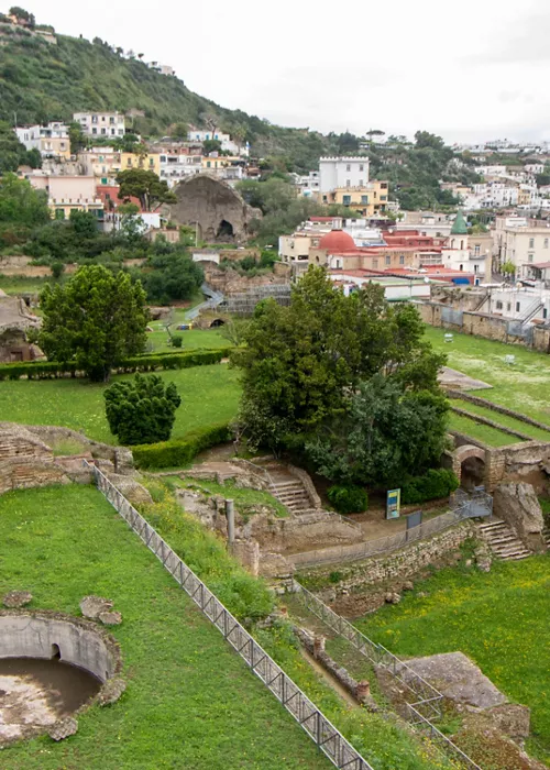
However, it is the Roman theatre that is the highlight of a cultural visit to Sessa Aurunca, immersed in a green landscape, at the southern end of the town. The story goes that the emperor Augustus himself inaugurated this majestic structure, which is still used today in the summer for events, shows and concerts.
Moving again towards the historical centre, one comes across the Cathedral of Sts. Peter and Paul, the other symbol of the city, which may remind one of the basilica of S. Angelo in Formis in terms of form and ornamentation. The cathedral of Sessa Aurunca is, in fact, also from the Romanesque period and reveals decorative geometries on its floor that are reminiscent of Arab art.
Before resuming the route to the north, the Real Ferdinando bridge is worth a detour, which crosses the Garigliano river along the Appian Way, surrounded by the typical pine forests of the Tyrrhenian Sea. This bridge, strongly desired by the Bourbon rulers around 1828, was the first completed suspension bridge in Italy and is now part of the Roccamonfina Volcanic Area and Garigliano Mouth Regional Natural Park.
Roccamonfina

Travelling up the Garigliano river from the Real Ferdinando bridge inland you enter the unspoilt landscape of the Roccamonfina Volcanic Area and Garigliano Mouth Regional Natural Park. Among the highest volcanoes in Italy, with an altitude that exceeds 1000 metres, the inactive volcano of Roccamonfina takes its name from the most important village that rises just south of its summit.
The town of Roccamonfina was also enriched in the past, as was that of Sessa Aurunca, thanks to the trade routes that passed through here in the direction of Rome. The village is nestled in a picturesque green chestnut forest, invigorated by the rich volcanic soil around it. This is why many locals say that the best time to visit Roccamonfina is in October, when the chestnut and porcini mushroomfestival perfumes and colours the village streets.
To witness a particularly heartfelt religious tradition in Roccamonfina, choose the month of May, on the occasion of the Calata di S. Antonio dai Làttani. From the sanctuary of S. Maria dei Làttani, located just north of the village, the inhabitants accompany a statue of S. Antonio from Padua along a procession in the direction of the historic centre. The saint watches over the residents of Roccamonfina throughout the summer, before returning to his usual location during the month of August. The sanctuary of S. Maria dei Làttani is also worth a visit during the rest of the year, to marvel at the church's Gothic vaults and frescoes. A statue of a Madonna with child, carved in around the year 1000, has been attracting groups of pilgrims for centuries.
Piedimonte Matese

The itinerary ends in a naturalistic setting of great charm, the Matese massif, on the northern border of Campania with Molise.
Starting from Roccamonfina, it takes about an hour to reach Piedimonte Matese, the main access point to the Apennine peaks. Already from the place name, it is clear that this village is located right next to the mountainous reliefs, at a point of passage for those who wish to descend from here to the sea.
After repeated invasions and destruction in the Middle Ages, Piedimonte Matese established itself in the modern age as an important centre of wool and textile production. On the other hand, it is necessary to travel back in time to the fourth century BC to better appreciate the impressive dimensions of the megalithic walls preserved in the Parco Archeologico Monte Cila, just outside the historic centre.
The Piedimonte Matese area has been the scene of stories and battles for millennia, but today it is above all known as a landmark for those visiting the Matese Regional Park. An evocative series of gorges, forests and rocky peaks attracts sports enthusiasts and outdoor lovers, who gather on the shores of Lake Matese, at the centre of the park. Mountain biking and climbing, horse riding and rafting, even snowshoeing and skiing when the snow covers the massif: the choice of sports activities is almost endless.


