Tolmezzo

Tolmezzo is located at the point where the course of the Tagliamento is intercepted by the But tributary, and is an important historical settlement at the intersection of the roads linking the Cadore region of Veneto, Austria and the plains towards the sea. The town probably has Roman origins, and already in the 14th century it had obtained privileges from the Patriarchate of Aquileia, which recognised it as the main town of Carnia. It has been part of Italy since 1866. It previously belonged to the Austro-Hungarian Empire.
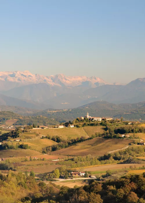
Awarded the title Alpine Town of the Year 2017, Tolmezzo is an important tourist town as it has many amenities, info points, hotels and shops. But Tolmezzo itself, with its picturesque borgàt (old town centre) certainly deserves at least a few hours' exploration. You can still see traces of its medieval street plan, the artworks in the Cathedral of St Martin, enjoy a walk up the hill from the Church of St Catherine to the Picotta tower (a memory of Tolmezzo's days as a fortified town), and finally the 'Michele Gortani' Folk Museum, where you can learn all about the arts, crafts and traditions of Carnia. Of course, the area also offers plenty of opportunities for hiking, amid the mountain lanscapes, alpine huts and rural churches, or along the many cycle paths that lead to the famous Alpe Adria Radweg.
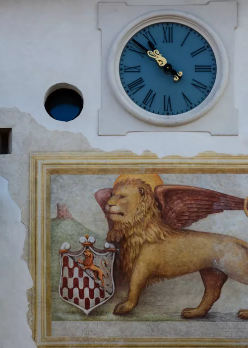
The important proto-industrial history of the weaving of fabrics, damask, satin and taffeta dates back to the final decades of Tolmezzo's long affiliation with the Republic of Venice (from 1420 to 1797). It was established by Jacopo Linussio (1691-1747), a native of nearby Paularo, who came to employ four thousand five hundred spinners and to regularly export overseas. The domestic production by Friulian families on behalf of Linussio's company could now be described as a pioneering example of smart working.
Lake Verzegnis

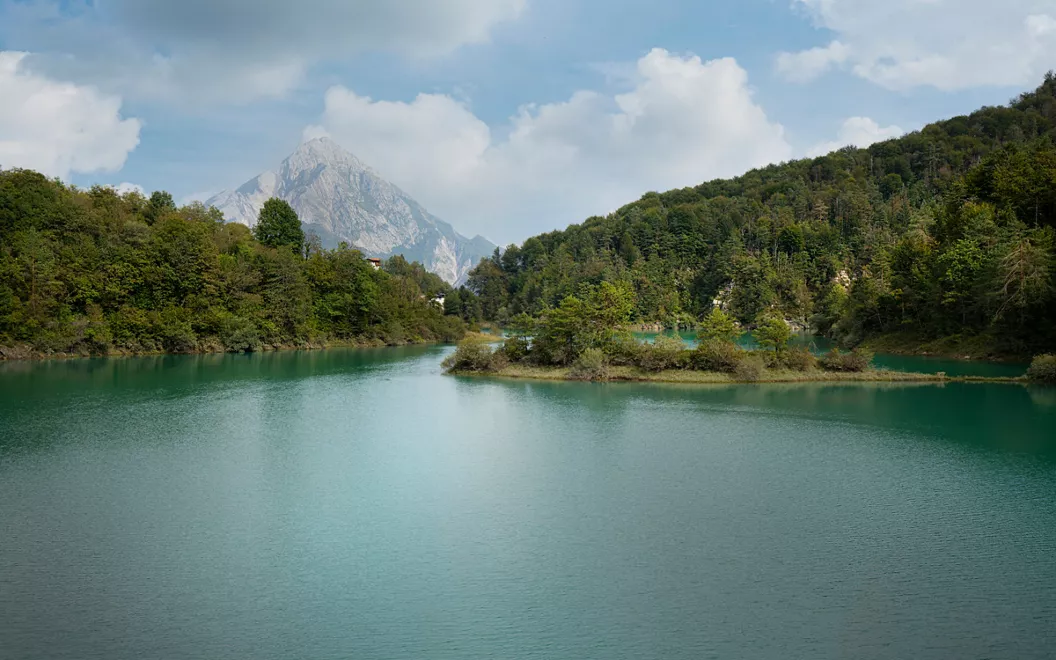
South of Tolmezzo, the villages and hamlets of the municipality of Verzegnis can be reached in a few kilometres, on a plateau rich in orchards, beech and chestnut trees. Verzegnis lake is a spectacular reservoir that feeds the Cavazzo hydroelectric power station and also creates a vast and peaceful natural environment to be explored on foot or by mountain bike. The lake is not suitable for swimming but can still be fully enjoyed, with walks along the shores towards the large dam or relaxing moments with a fishing rod.
Upstream of the lake, the Sella Chianzutan pass offers high-altitude views and the opportunity to visit red marble quarries, for which a remarkable industrial archaeology project has been realised. The Lavoreit Ros quarry and the Verzegnis Historic Marble Route have been recovered and promoted.
Archaeological excavations conducted around the medieval tower of Mazeit hill, in the Villa di Verzegnis district, have brought to light objects and remains of buildings that date the settlement back to the 11th century BC, and testify to its importance in Celtic and Roman times.
A final detail. A family to which the history of Italian digital civilisation owes a great deal are originally from Verzegnis. The town of Chiaulis is the birthplace of Enore Deotto (1923-2008), a director at Olivetti in Ivrea and later president of the large public trade fairs that introduced the use of computers to Italy in the 1960s and 1980s.
Sauris Lake

A quick glance at the map of linguistic minorities in Carnia would immediately show that Sauris, which lies some thirty kilometres north-west of Tolmezzo along state road 52 and provincial road 73, is a German-speaking enclave. The village was founded in the middle of the 13th century by a group of woodcutters, who probably came from the valleys bordering Tyrol and Carinthia in Austria. They were not places from which it was easy to move around and the community, isolated for centuries, has kept its original dialect, festivals, customs and traditions virtually intact.
Climbing the narrow valley of the Lumiei torrent from Ampezzo, an unexpected pool of blue takes your breath away. A 136-metre-high dam inaugurated in 1948 (the highest in Italy at the time) forms the Sauris reservoir, for hydroelectric power, although natural in appearance. With the construction of the dam, an artificial basin (the present-day lake) was created, with a water capacity of more than 70 million cubic metres. If what you see is not water but the remains of the ancient village of La Maina down below, it's because you have arrived during one of the rare occasions when the lake is drained for maintenance.
It goes without saying that nature-based activities find a perfect environment here: hiking, canoeing, windsurfing, sport fishing and, slightly less natural, dizzying descents of over a kilometre across the water by zip-line.
Olbe Lakes

This is where the series of naturally-formed Carnic lakes starts - in the municipality of Sappada - reached from the village of Sappada along trail 135, classified as easy although with a total elevation change of around 1,000 metres.
The three Olbe lakes are small basins of glacial origin on a plateau where the silence of the Alps surrounds rocks, meadows and water. The environment is typically unspoilt, yet not entirely alien to modernity as it is quite close to the mountain station of the Sappada 2000 chairlift. So, in short, you don't have to be an experienced rock climber to be able to say, "We've made it!"
The path from the hut to the area of the lakes - which in old Sappada German are called Olbe seaber - acquaints you with the ancient civilisation of the alpine pastures. Near the eastern lake, the largest of the three, you can often encounter grazing cows, placidly signalled by the regular ringing of their bells around their necks.
Lake Bordaglia

If the question of administrative borders made any sense at high altitudes, you might be aware that the Bordaglia-Fleòns Wildlife Oasis - the largest not only in Carnia but in the whole of Friuli - lies within the territory of Forni Avoltri, Friuli's northernmost municipality, a fifteen-minute drive east from Sappada via Cima Sappada along regional road 355. The lake, which, like those in Olbe, is of glacial origin, is a must-see destination for nature and mountain lovers, set in a fantastic alpine backdrop between the grey ridges of the Volaia mountains and the green peaks of Fleòns.
Here, too, you can only go up wearing climbing boots, discovering the gorge of the Bordaglia stream along the way, with its waterfalls and wells, the peace surrounding the Bordaglia di Sotto hut, and finally the larch trees around the lake. It is not certain, but you might even catch a glimpse from afar of some of the deer or chamois that are resident in the area.
For the most indefatigable, Lake Pera – which in Forni they call Lâc di Pera, and is shaped like a pear – is not far away, close to the Austrian border. You can also reach the 1,951-metre altitude of Lake Volaia, on the shores of which a number of mountain refuges, located on Austrian territory, offer the opportunity to taste typical mountain cuisine and enjoy the sunrise in this majestic, pristine environment.
Lake Avostanis

At an altitude of 1,936 m, about four hundred metres higher than the Casera Pramosio Refuge, from which you usually walk up, Lake Avostanis is a small, striking example of a mountain reservoir created by glacial modelling. Both the refuge and the lake, located in the Creta di Timau mountain range, are close to Paluzza, a holiday resort along the But valley, east of Forni Avoltri and north of Tolmezzo.
The body of water is contained in a glacial cirque produced by differential rock erosion, and is fed by both spring snow melt and an aquifier. Its size and depth vary depending on the seasons and how much snow has accumulated beforehand. In winter, however, Avostanis is always frozen.
The couple of hours' ascent on foot makes you appreciate both the natural environment and human activity. You come across alpine pastures with the presence of agritourism, several Carnico grey marble quarries (one of which is still in operation), a very rare case of a well-preserved ancient mining tunnel for silver extraction (not open to visitors) and remnants from World War I. In addition, along the path that leads first to the lake and then to the summit, there are several memorials of the past, including the gravestone of Maria Plozner, a carrier from Carnia, who was shot dead by an Austrian sniper in 1916, during the First World War, while bringing supplies to the Italian soldiers on the front.
Lake Dimon

Already particularly striking in its own right, the lake also has the geological merit of indicating of the local effects of Würmian glacial erosion, given that fifteen thousand years ago, the area of Mount Dimon and neighbouring Mount Paularo was still covered by an ice cap, and, in particular, the region's response to glacial retreat and the new climate conditions.
As with Lake Avostanis, the most convenient reference point for Dimon is Paluzza, along state road 52 bis towards the Monte Croce Carnico Pass. The nearest village, however, is Ligosullo, a little to the east, where there is also Valdaier Castle, which serves as the starting point for the walk.
You climb from an altitude of 1,340 to over 2,000 metres, passing through very scenic environments, with shepherd's cottages that are no longer in use but can still offer shelter, and admiring the strange colours of volcanic rocks that are decidedly uncommon in the region, and equally rare flowers such as the Alpine pulsatilla. It is not a short trip, as you need to allow at least three hours for the ascent, and know in advance that it is a hiking route.
A short distance from the starting point, the Casera Valdaier cheese factory, with its farm produce, can serve as a rest spot.

