Sarzana

A route that rises and falls almost entirely in the land of Tuscany, starts in that sort of 'no man's land' shared by Liguria and Tuscany, but in this case the expression is improper: it would be better to say 'everyone's land', which is called Lunigiana. The name of this historical region derives from the ancient Roman city of Luni, whose excavations can be visited not far from Sarzana. So far, however, you are not yet in the Apuan Alps themselves: to really enter them, you will have to continue along state road 446 until you reach Fosdinovo.
Sarzana itself already displays a solid identity: it heralds the even more decisive character of the Apuan Alps thanks to its historical centre, all to be calmly strolled through up to the robust Firmafede Fortress, better if stopping at places such as the Co-Cathedral of Santa Maria Assunta to observe certain refined Renaissance presences.
Sarzana has been and is also the centre of significant cultural initiatives, especially with the many editions of the Mind Festival, at the end of summer, which has been held in the town since 2004 and is still held there.
Fosdinovo

Some ten kilometres of green, sometimes winding roads and more than four hundred metres of altitude difference separate Sarzana from Fosdinovo, which is the village with the medieval atmosphere where the itinerary begins to enter the Apuan environment in earnest. The scenic Malaspina Castle – named after the historically dominant dynasty in Lunigiana, which had one of its main family branches here – offers a splendid panorama from its walkways, ranging from the PDO vineyards of Colli di Luni to the sea at La Spezia. In addition to the castle, with its historically reconstructed rooms telling curious anecdotes, the Church of San Remigio is also worth a closer look. But it's a stroll through the town's gates, squares and oratories that really reveals its appealing nature. It is situated in an area certified by the Touring Club Italiano as a Bandiera Arancione or Orange Flag. From here, it's definitely worth driving around thirty kilometres along Provincial Roads 10 and 11 to reach the more remote Vinca, where the paths of the Apuan Alps within easy reach.
Carrara

From the Apuan Alps of Fosdinovo or Vinca ,the route continues to descend – for about twenty or thirty kilometres respectively – until it reaches the major town of Carrara, whose name is internationally synonymous with marble. The stone is almost entirely carved from the valley of the Carrione, a short stream that descends to Carrara, crosses the city and ends up flowing into the sea alongside Marina di Carrara, where there is both an industrial port and a large marina for sailing boats.
It's no surprise that Carrara Cathedral, dedicated to Saint Andrew, is also made of marble, including the extraordinary rose window on the façade. In the square, the statue depicting Andrea Doria as Neptune, ruler of the seas, is a remarkable piece of 16th-century Florentine sculpture, while the plaque commemorating the burning at the stake of the 16th-century philosopher Giordano Bruno is signed by local anarchists, a community that has been a well-known part of the city's identity for centuries.
Marble is also at the heart of MudaC, Carrara's Museum of Arts, with its collections of contemporary works in the former 17th-century Convent of San Francesco, and of the Academy of Fine Arts: here, children nowadays also use digital media to learn to create.
Colonnata

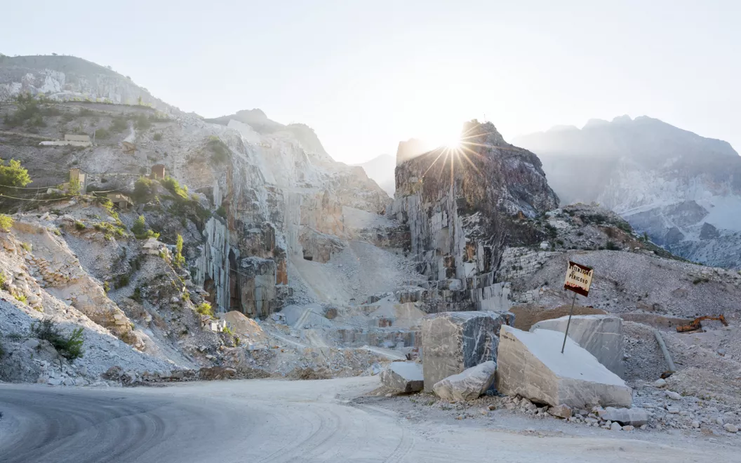
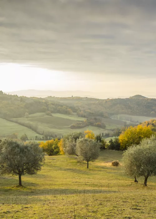
You wouldn't think to ask why the section of the Apennines immediately upstream of Carrara is called the Apuan Alps and not – as geography would dictate – the Apuan Apennines. A mere glance answers the question. The landscape is one of dizzying peaks, even towering above hills covered with olive trees. The amphitheatres of the marble quarries, centuries-old rifts in the rock, offer spectacles akin to Dante's circles of hell. They bring to mind the Dolomites, but they don't go pink as the sun sets – if anything, they turn light blue. The distinction between the Alps and the Apennines isn't the only linguistic exception that applies here. In the everyday speech of Colonnata – less than ten kilometres inland from Carrara, and thus more than five hundred metres higher – the Apuan Alps are called the "Panie", while the gashes that can be seen in the mountain, with the flow of marble rubble being excavated, are known as "ravaneti".
Colonnata, meanwhile, is a brand name all over the world for another reason: its production of lard, a real example of Italian brilliance.
Massa

The province of Massa-Carrara. It is located in a region with a dual name, although you wouldn't know it from the car licence plates: here, the city of Massa is the capital and dominates with the two consonants "MS", while poor Carrara doesn't even get a look in. To drive between the two cities, you can choose between a shorter and more inland route in the shadow of the Apuan Alps (less than eight kilometres) or a much more industrial route that follows a stretch of State Road 1 Via Aurelia. Even so, the latter is only just over ten kilometres, weaving between pine forests towards the sea and rows of marble-trading establishments. The bridge cranes used to lift the blocks are the giveaway.
Historically, Massa was surrounded by nature, a fact alluded to by the name of the central Piazza Aranci, where, to quote author Giacomo Leopardi, "in the middle of the public square grow orange trees, planted in the ground". This open space is flanked by the Ducal Palace, built in the 1500s by the Cybo-Malaspina dynasty, rulers of the region after the Cybo family had married into the preceding Malaspina dynasty: we've already encountered them on our travels in Fosdinovo, and the castle in Massa bears their name.
In addition to its historical heritage, Massa is important as the home to a major visitor centre for the Apuan Alps Regional Park, the vast protected area upstream that has been part of the UNESCO Global Geoparks network since 2012.
Forte dei Marmi

From inland, the itinerary now takes a rare trip to the coast, paying homage to a resort town famous for its beaches, discos and local parties, with contests between teams of lifeguards, liturgical celebrations and fireworks. There are actually two excellent reasons to visit: the first is the skyline that acts as a backdrop to the town, formed by the peaks of the Apuan Alps, and the second lies in the name of the fort itself: here, the "Marmi" (marbles) are a matter of identity and are written with a capital "M", while the Fort still stands proud, having been built in the late 18th century by the Florentine duchy to oversee the shipping of marble to distant lands. In other words, it wasn't just from Carrara that the precious stone extracted from the quarries was shipped around the world.
From Forte dei Marmi, the itinerary begins to come to an end, returning to the mountainous inland and passing through Seravezza en route to the marble-producing village of Levigliani. Another possible conclusion is to go via Pietrasanta and ascend to Sant’Anna di Stazzema with its National Peace Park.
Levigliani

Levigliani really is an unusual place. The other towns in the Stazzema area, in the heart of Monte Corchia in the Apuan Alps, upstream of Forte dei Marmi, are all practically devoid of residents nowadays. Not so here. In fact, young people are actually coming here to settle down, leaving their hometowns behind. Why? How come?
The answer lies around twenty kilometres uphill from Forte dei Marmi, along Provincial Roads 68 and 9. The roots of Levigliani's success lie in the capacity for self-organisation demonstrated by the local community.
For those arriving as visiting tourists, the result today is a guided tour lasting two and a half hours (tickets can be purchased in the village at Corchia Park, corchiapark.it). A protective helmet is required, as the tour explores the Piastraio Caves – depths of dazzling rock in the midst of verdant hills, between the square walls of already-excavated marble. Visitors can also meet new entrepreneurs producing organic wine at altitude or cheeses prepared with sustainable methods using strictly local sheep's milk. It's a win-win for residents and visitors alike.
In reality, the distant roots of this appeal and today's tourist services go back further in time to the 1700s, when about sixty heads of household from Levigliani resisted the Grand Duke of Tuscany's decision to dispose of communal state property and abolish its collective use: the families reacted by purchasing their long-established land with their own money and managing it themselves as a shared property: a sort of community cooperative!
Ever since then, the residents have never abandoned this commitment – in fact, they have become better organised and structured over time. A clear demonstration, in short, that given certain conditions and a certain degree of sharing, tourism can form the basis of the economy.
